Cartographica Neerlandica Background for Ortelius Map No. 74
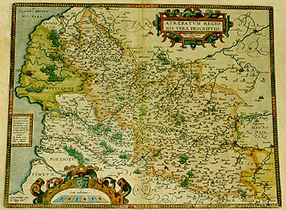
Title: Artois./ATREBATVM REGIO:/NIS VERA DESCRIPTIO./Johanne Surhonio Montensi/auctore (bottom left corner:) Cum priuilegio Imp./et Regie Ma.tis (cartouche lower middle left:) Illustri ac ampliss:/simo viro Domino/Christophoro ab/Assonleville, equi:/ti aurato Domino/ab Altevilla R.Mts./consiliario pri:/mario,/Ab Ortelius in hanc/formam comprehen:/debat, et dedicabat.
Plate size: 378 x 485 mm
Scale: 1 : 300,000
Identification number: Ort 74.
Remarks: when I published the book "Ortelius Atlas Maps" in 1996, I encouraged readers to send me information on new plates and new states not described in my book. As a result, I have received much information on new states and found quite a few myself as well, which have meanwhile been incorporated on this website.
However, inventive and meticulous research by Joe Q. Walker has demonstrated that I postulated too many new plates, rather than too few.
He demonstrates that plate blemishes such as scratches and spurious dots occurring on Ort 72 also occurred on plate Ort 74. Therefore, the existence of a separate plate Ort 74 cannot be upheld. Walker has published the arguments leading to this conclusion in detail in a monograph "The Maps of Ortelius and their Variants", Antiquarian Maps Research Monographs - 1, which can be obtained from him on request through Email Martran@msn.com
I am happy that I have been informed about this research, since it increases our knowledge on Ortelius' maps.
No map text available
No bibliographical sources available
No topographical names available
For questions/comments concerning this page, please e-mail info@orteliusmaps.com.
The software that generates this website is available for sale. For more information, contact Thomer M. Gil.
This page has been generated on Tue Nov 18 09:48:00 2008.