Cartographica Neerlandica Background for Ortelius Map No. 135
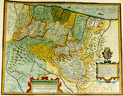
Title: DVCATVS VRBINI NOVA | ET EXACTA DESCRIPTIO. | M.D.CVI. [A most accurate depiction of the duchy of Urbini]. (Cartouche lower right:) SERENISSIMO ET EXCELL.MO | PRINCIPI FRANCISCO MARIAE | II. DE RVVERE, VRBINI DVCI, | IOAN. BAPT. VRINTIVS ANTVERP. | AEMVLVS REI GEOGRAPHICĆ | SACRA DEVOTIONE DEDICAT. | OBSEQVIVMQ. AETERNVM | DEFERT. [Ioannes Baptist Vrients, intent on geographical matters, in holy devotion dedicates this map to the glorious and excellent Lord Franciscus Maria II de Ruvere, Duke of Urbino, in eternal obedience].
Plate size: 381 x 487 mm.
Scale: 1 : 450,000
Identification number: Ort 135 (Koeman/Meurer: 159, not in Karrow, vdKrogtAN: 7360:31).
Occurrence in Theatrum editions and page number:
1608/1612I93 (300 copies printed) (due sommi Pontefici, & molti Principi, & Generali d'esserciti su di poi accresciuto assai.),
1609/1612L94 (300 copies printed) (last line, left aligned: que Ductoribus insignis eam valde auxit.),
1609/1612/1641S94 (325 copies printed) (last line, left aligned: accrescentado de los Roueres, que por parentesco y adoption son enxeridos en la familia Feltresca.).
Approximate number of copies printed: 925.
States: 135.1 only.
Cartographic sources: this map is based on the single sheet map of the Urbino area which Giovanni Antonio Magini (1555-1617) drew and published in 1596 (Meurer p. 189).
For questions/comments concerning this page, please e-mail info@orteliusmaps.com.