Cartographica Neerlandica Background for Ortelius Map No. 40
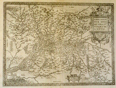
Title: Anjou | ANDEGAVEN:|SIVM DITIO:|NIS VERA ET | INTEGRA DE:|SCRIPTIO. | "Licino Guijeto | Andegavense | auctore". [A true and comprehensive depiction of Anjou, [and] area of the Anjou people, by Licinus Guijetus from Anjou] (bottom left, right half:) "Cum Priuilegio .1579." [With privilege, 1579] (Top left:) "Pons Danij | dictus, Ande:|gauensium di:|tionem ŕ Bri|tannia separans". [The bridge called Danius separates the area of Anjou from Bretagne.] (Bottom right:) "Prelium hic commißum, | quod Moncontour uulgo | nomen habet". [The battle fought here is commonly called the Moncontour battle.]
Plate size: 353 x 467 mm
Scale: 1 : 350,000
Identification number: Ort 40 (Koeman'Meurer: 76, Karrow: 1/111, van der Krogt AN: 4440:31)
Occurrence in Theatrum editions and page number:
1579/1580L2Add14A (250 copies printed) (10th line from the bottom ends: Ptolemći Iu- ; last line, centred like 3 lines above it: velit potest adiungere.),
1579L(A)19 (250 copies printed) (10th line from the bottom ends: Ptolemei Iu- ; last line, centred like 3 lines above it: velit potest adiungere. ; first text line ends Lugdu-),
1579L(B)19 (250 copies printed) (10th line from the bottom ends: Ptolemei Iu- ; last line, centred like 3 lines above it: velit potest adiungere. ; first text line ends Lug-),
1580/1589G19 (350 copies printed) (last line, centred like 3 lines above it, in Gothic script: thun.),
1581F19 (400 copies printed) (last line, left aligned: adiouster le Theuet.),
1584L23 (750 copies printed) (last line, centred like three lines above it: Theuetum his qui velit potest adiungere.),
1587F23 (250 copies printed) (last line, left aligned: Qui voudra, il poura adiouster le Theuet.),
1588S23 (300 copies printed) (last line, centred like 4 lines above it: dra ańadir a Theuet.),
1592L24 (525 copies printed) (last line, centred like three lines above it: Theuetum his,qui velit, potest adiungere.),
1595L25 (500 copies printed) (11th line from the bottom ends: cőfluât. ; last line, left aligned: velit, potest adiungere.),
1598F31 (525 copies printed) (last line, left aligned: ceste Carte. Qui voudra , il y pourra adiouster le Theuet.),
1601L25 (200 copies printed) (11th line from the bottom ends: confluant. ; last line, left aligned: velit , potest adiungere.),
1602G25 (250 copies printed) (last line, centred like 3 lines above it, in Gothic script like the entire text: thun.),
1602S25 (250 copies printed) (last line, left aligned: leforestio. El que quisiere podra ańadir a Theuet},
1603L25 (300 copies printed) (typesetting, but not page number, is identical to 1609/1612L; last line, left aligned: Theuetum his, qui velit, potest adiungere.),
1606E25 (300 copies printed) (last line, left aligned: adde "Theuet".),
1608/1612I28 (300 copies printed) (last line, left aligned: gere il Teueto a quanto detto č di sopra.),
1609/1612/1641S27 (325 copies printed) (last line, left aligned: quisiere podra ańadir a Theuet.),
1609/1612L27 (300 copies printed) (typesetting, but not pagenumber, is identical to 1603L. Last line, left aligned: Theuetum his, qui velit, potest adiungere.).
Approximate number of copies printed: 6575.
States: 40.1 above.
40.2: dotted line borders of Anjou were introduced in 1592L.
40.3: during or after 1612S the date 1579 was removed.
Cartographic sources: Lost original by Lezin Guyet (1515-1580), published in Paris in 1573, dedicated to the Duke of Anjou (Meurer p. 162).
For questions/comments concerning this page, please e-mail info@orteliusmaps.com.